Hiking around Hong Kong Island
I spent three weeks in East Asia recently, together with two friends – we travelled to Hong Kong, Shenzhen, and Taiwan!
Occasionally, I went hiking, to train for an upcoming 100-kilometer hike. Here’s a report of my favorite trip! It has been adapted from this Mastodon thread, which I live-tooted as I walked!
We were in Hong Kong, and I was looking for suitable trails for a hiking day. The Hong Kong Trail seemed popular, but led through the mountains. Because I wanted to train long-distance hiking in a flatter terrain, I decided to just… start walking along the coast of Hong Kong Island (which forms the “core urban area” of Hong Kong), and see how far I’d get!
Our hotel was in Western District, which is bustling and densely-populated. In the morning, I walked to the coast, and started following it in a clockwise direction.

The weather was really nice – not too sunny, but a pleasant 20 degrees Celsius. What was nice about a “around the island” hike was that I rarely needed to look at maps.
There were several smaller islands along the coast. For example, I walked past 青洲 – Green Island!

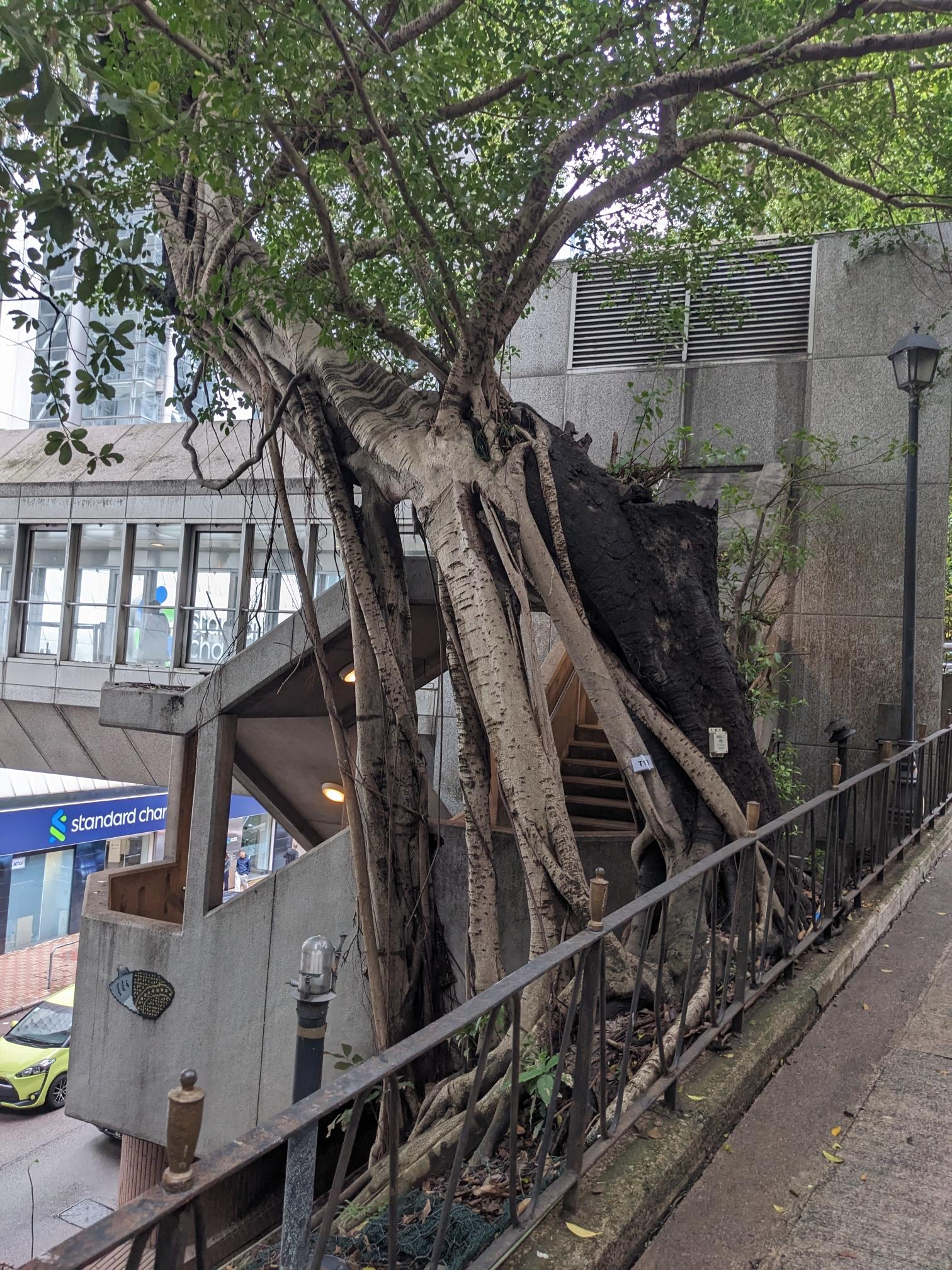
As I was following the streets, I found these trees, which were working really hard at reclaiming the city here!

We’d seen more of these trees in days before that! I looked it up – it’s called the Chinese banyan aka “curtain fig”. And it seems that it’s sometimes actively used to stabilize slopes! We later nicknamed them “melting trees”.
Here are some more photos of these banyans that we’d seen around the city:


I found this street sign, and had to share it with Mastodon: “Don’t toot!” 😬 Or rather, maybe I was now allowed to toot again?

I made it around Mount Davis, and reached Waterfall Bay!
This part of the coast consisted of a couple of connected public parks, which felt nice to walk in.


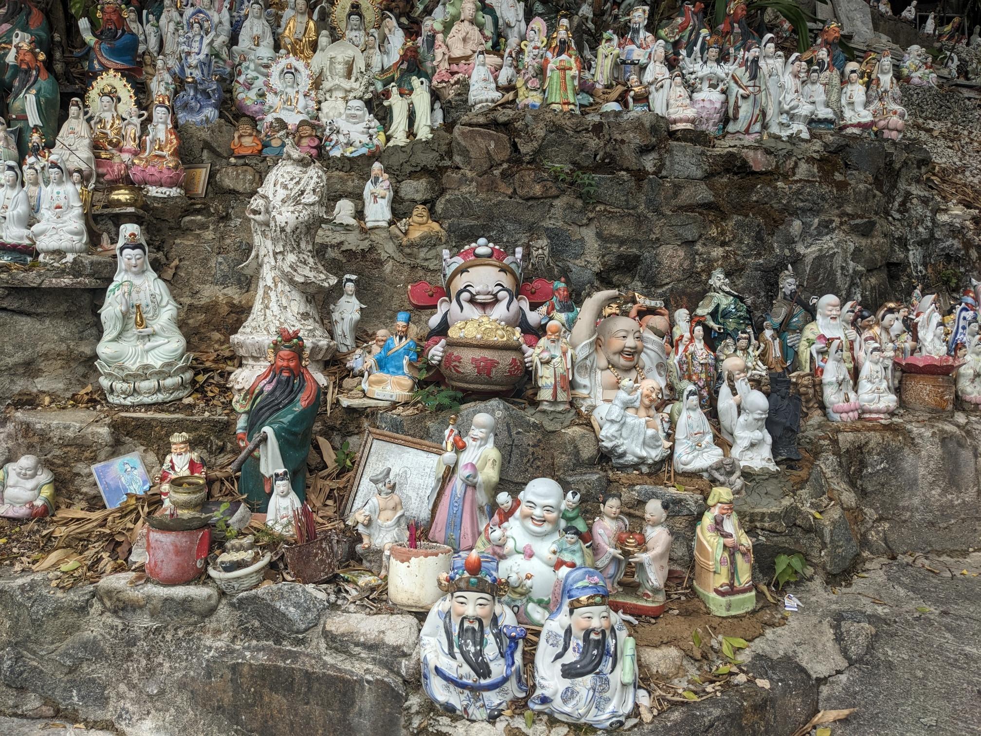
As I was getting closer to the southern part of Hong Kong Island, and discovered an area with lots of ceramic deity figures! It seems that instead of discarding your deity figure, you can bring them here, and a member of the local community will take care if them. There were many hundreds of them!

I reached an area called Aberdeen in the South. Funny how a place where the Chinese language dominates, many things have very British names! But of course, that’s because Hong Kong was a British colony for 150 years.
Here, I accidentally walked into a commercial fish market, where people were moving around living fish and crabs in styrofoam boxes! From where I entered, it seemed like the area was open to the public, but I got increasingly unsure as I kept walking. Got some stares from the people working there, as well, but it seemed to late to turn around. As I left on the other side, I saw a definite “do not enter” sign. 😬 Ooops.
Made this joke on Mastodon:
Other places I’ve been to: “Oh yeah, the city has a downtown area, and there you can find a couple of higher buildings.”
Hong Kong: *casually sprinkles 40-storey skyscrapes all over the place*
I hadn’t expected to find as many skyscrapers at this side of the Island. But it turned out they are just all over:

A bit later, I made it to Deepwater Bay, the first beach I’ve seen here. I had a break here, took my shoes off and snacked on the fruit I had packed. I had been hiking for around 3 hours at this point.

Not far ahead, I found Tin Hau Temple, which is dedicated to a Chinese sea goddess. I liked the colors and little details here. Much of it was open-air, and many people seemed to come here to pray. They lit incense sticks, and bowed in front of the different statues.

According to what I had read the evening before, the “around-the-island trail” I was following was still in construction. Several road along the coast were not built out sufficiently to be part of the trail. Because of that, the track I was following denoted a couple of “safe deviations”. So far, they seemed to lead around construction sites, for example, and once, to avoid a locked gate (which I realized too late, and which caused me a ~2 km detour. 🤦
But for the grey part in this next map, I was quite glad that I didn’t follow the deviation, and instead followed the shore!

As I approached the intersection where the deviation forked off from the coast, I had to make a decision of which path I should follow. It seemed like a bit of a gamble: Following the shore could be a really pretty and interesting path (instead of walking along a street).
On the other hand, the path could be impassable, or dangerous.
I also (again) realized too late that the official route would go another way, so it would’ve cost me time to turn around. I decided to see how far I’d get!
It quickly turned out that it would be an uphill hike. The first few steps were still made from concrete…

…but the stairs quickly turned into a somewhat crumbly (but safely walkable) situation.

So I followed this path up for maybe 20 minutes. At ~22 °C, I was sweating a lot!
A mid-forest crossroads had this beautiful way of marking the different directions!

At one point of my ascent, I met two people hiking downhill, which gave me a feeling or relief: I would be able to get through there somewhere!
Eventually, the view opened up, and revealed the Stanley Peninsula! It was a really pretty sight!


I continued on that path for a bit longer, and eventually reached a street made from concrete, that led to a water reservoir on the top of the mountain. From here, I could hike down to the town that I’d seen. Again, I felt relief, and emptied my entire water bottle in one go!
That was a neat little sub-adventure! :D


A bit later, I made it to Stanley, where they had a nice pier going into the water:

And just as I was considering my next steps, suddenly these folks turned up! :’D It was my two friends that I was doing the vacation with, @robbi5 and @ubahnverleih!
We had joked about playing “tag” (and I was carrying an AirTag so they could see on a map where I was), but I hadn’t actually expected to be hunted across the island! xD

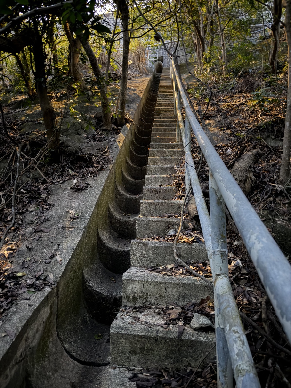
We continued the hike together! The next section of the tail was fun: We hiked upwards into a mountan a bit, and there, we met a water collection canal, which we followed for an hour or so. At this weather and time of year, it was completely dry.

The canal continued curving along.

That was a very pleasant path, which was almost entirely flat, because, well, it was a water-carrying canal. Except for a couple of “water stairs” in between and in the end. The canal finally ended in a water reservoir.

From there, we entered a peaceful bay. One person there seemed very surprised that three foreigners would pass through here.

We also found this bike graveyard close to a settlement:

We encountered this this dam, and @robbi5 must’ve spotted the glittering in my eyes, because he said: “No blinry, we’re not going up there!”

Somewhere around here, we decided to deviate from the semi-official “around-the-island” trail, and rather directly walk North, to meet the closest metro station, and head home before it would get dark.
So we followed up a dry river bed.

“If it’s mapped as a path in OpenStreetMap, we can walk it”, right?
Luckily, someone had attached ropes to some ropes here, to make it easier to make it up the steep slope.

We encountered another intersection, and looked at our OSM map. One option was heading directly north, following a pretty straight path. Another one was deviating to the East, going along a more twisted path. The straight one seemed easier to us, so we went with that one.
We quickly discovered a thick metal pipe, which was partly buried into the ground here, going along the path that we’d chosen. Seemed fun!

But then, the ground gave way, and only the pipe remained.

I joked on Mastodon:
Next, we balanced along this pipe… 😱
Just kidding.
We won’t actually need to do that.
I think.
For this first section, it was possible to walk alongside it (where you see Jenny in the picture).
But after a couple of meters, this was not possible anymore, and balancing was, in fact, what we needed to do! I tooted:
Ummm.

Again, someone had attached a thick cable and a rope we could hold onto. Still, this was unnerving and I was definitely a bit scared. You couldn’t see the ground very well through the vegetation, it went down maybe a couple of meters?
There were two or three of these “pipe crossings” that we needed to do, one by one. What had we gotten ourselves into?! 😬

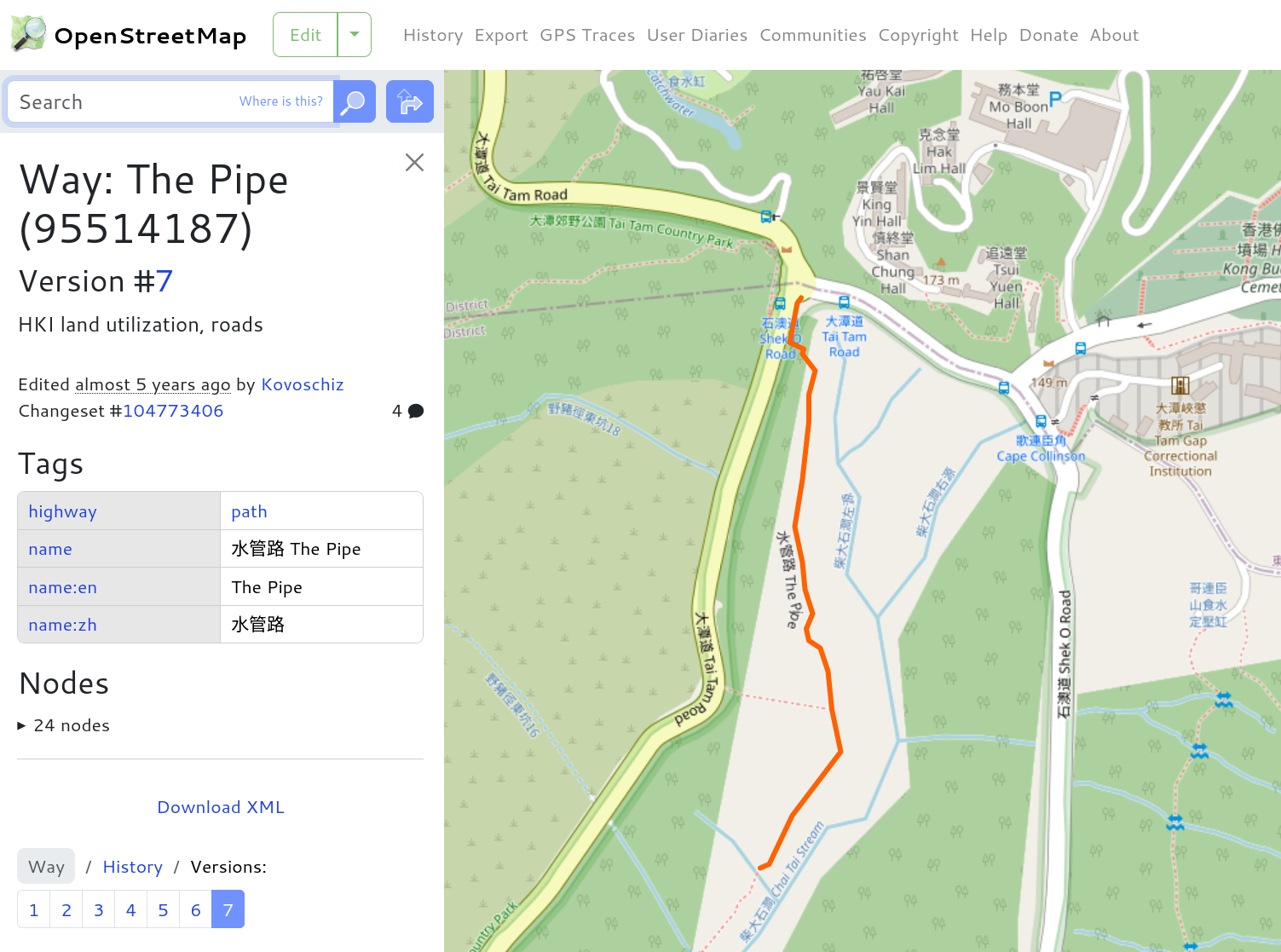
Rohieb later discovered that this path is actually called “The Pipe” / 水管路 in OSM! @noiob joked that maybe we should edit that path to have the correct tags: “Steel pipe, with handrail”! :P
Eventually, we hit some stairs going up to street level. These stairs, and maybe the entire path, was probably used for “slope maintenance”?

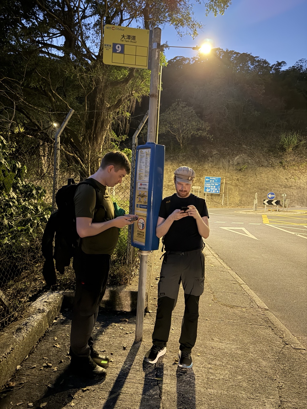
Luckily for us, there was a bus stop directly where we came up to the street. Our energy was pretty depleted at this point, so without a long discussion, we agreed to just take a bus to the closest metro station, and to get dinner – some Japanese curry!
The three of us hadn’t travelled together before this vacation, and this was in the first few days of our trip! I think sharing this little adventure was a really good bonding experience, and I still think back to it fondly! :D
Finally, here’s some stats and a map of my hike that day (recorded using the open-source Android app “RunnerUp”). Even though I didn’t make it fully around the Island, it was still a really nice adventure!

Thanks to Jenny for proof-reading this blog post! Some photos were also taken by her. You can usually tell by their high quality! :P
Join the discussion!
You can add your comment in the Fediverse! Alternatively, drop me a mail at mail@blinry.org. Also, you can support me on Patreon or subscribe to my newsletter